
Click on a image to download the pdf


Maps
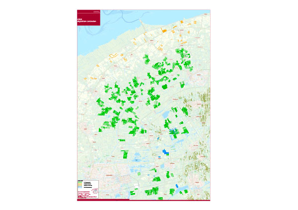
Map 1: ANLb/Diversity of AEC measures
- Green: Open Meadowland - target species: meadowbirds like blacktailed gotwit / lapwing / redshank
- Orange: Open Arable land - target species: Skylark, Yellow wagtail, Meadow Pipit, Yellow Hammer, Partridge
- Brown: Drymeandering veins / bocage landscape - hedgerows: targetspecies: Common Redstart, Yellow Bunting, Common Linnet, Grey big eared bat
- Blue: Wetmeandering veins - ditches, ponds and banks - target species: Bitter prash (fish), Eel, Snipe, Northern Shoveler.
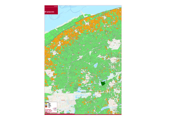
Map 2: grondgebruik/Use of soil
- Orange: arable land (northern part mostly potatoes, seed potatoes, unions, granes, beets for consumption and export / middle part mostly mais for dairyfarms).
- Green: meadowland for dairyfarms
- Purple: fallow land
- Dark green: nature preserve areas
- Red: ground depot
Download:
Gewaspercelen_Use-of-soil (pdf, 4MB)
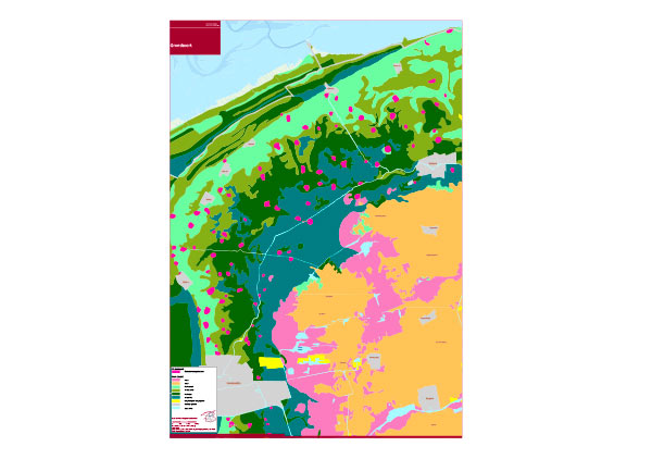
Map 3: Bodemkaart/Soil map
- Purple: Old settlement places
Soil type
- Lila: peat
- Orange: sand
- Light green: light savel
- Green: heavy sand
- Dark green: light clay
- Dark blue: heavy clay
- Yellow: raised or sprayed
- Grey: urban area
- Light blue: fresh water
Download:
Grondsoort_Soil-map (pdf, 3MB)